File:Mie Map.png
From Mie Guidebook
Size of this preview: 380 × 600 pixels. Other resolutions: 152 × 240 pixels | 534 × 843 pixels.
Original file (534 × 843 pixels, file size: 345 KB, MIME type: image/png)
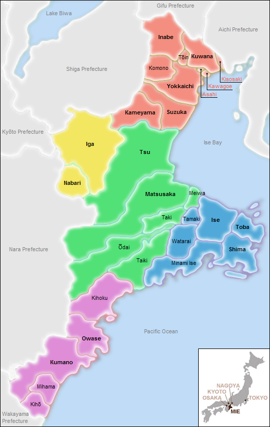
Map of Mie Prefecture, with cities and towns labeled and color-coded by region
File history
Click on a date/time to view the file as it appeared at that time.
| Date/Time | Thumbnail | Dimensions | User | Comment | |
|---|---|---|---|---|---|
| current | 17:52, 20 April 2010 | | 534 × 843 (345 KB) | Jpcase (Talk | contribs) | Resized, added ocean labels, black border, and Kisosaki/Asahi/Kawagoe map points |
| 18:53, 11 April 2010 | 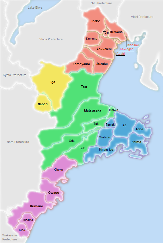 | 568 × 843 (337 KB) | Jpcase (Talk | contribs) | Map of Mie Prefecture, with cities and towns labeled and color-coded by region |
- You cannot overwrite this file.
File usage
There are no pages that link to this file.